Gwangmyeong
 |
Gwangmyeong is home to one of the world's largest IKEA stores at 59,000 square meters (640,000 square feet), along with a large Costco store and a Lotte Premium Outlet.
Gwangmyeong City area was part of the old (or original) Siheung County as with Yeongdeungpo, Guro, and Geumcheon areas. It belonged to West (서면, seo-myeon) and South townships (남면, nam-myeon) of original Siheung County. In 1914, the two townships were merged into West township of "expanded" Siheung County.
In 1963, the northern part of Gwangmyeong (at that time, the northern part of West Township in Siheung County) area was merged into an expanded Seoul (i.e. districts for urban planning in Seoul. 서울시 도시계획구역 seo-ul-si do-si-gae-hoeg-gu-yeog) as with Gwacheon (at that time Gwacheon was a township in Siheung County) and Sindo township of Goyang County (now parts of Goyang City which borders Seoul). The neighbourhood of Gwangmyeong (Gwangmyeong-dong) and Cheolsan (Cheolsan-dong) were developed as a residence zone next to Seoul and it was provisionally planned to be administratively merged with Seoul Metropolitan City. In 1974, Gwangmyeong-ri and Cheolsan-ri became a part of the county branch of Gwangmyeong (광명출장소 gwang-myeong-chul-jang-so) and in 1979 southern part of Gwangmyeong area became Soha town (소하읍 so-ha-eub). In 1981, the annexation to Seoul foundered as Seoul's unexpected rapid growth greatly concerned government officials. Consequently, the county branch of Gwangmyeong and Soha town merged and formed a new city of Gwangmyeong, instead of being annexed to Guro-gu, Seoul.
In the 1980s and the early 1990s, many apartment complexes were built in Cheolsan-dong and Haan-dong. The population increased up to 300,000. In 1995, the Seoul-Gwangmyeong boundary was readjusted, in which a tiny part of Cheolsan-dong was merged into the newly created Geumcheon-gu, Seoul. In 2004, Gwangmyeong Station was open, and in 2010, apartment complexes in Soha-dong were built up.
Map - Gwangmyeong
Map
Country - South_Korea
 |
 |
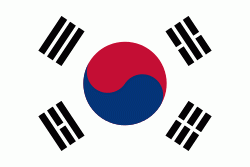
| Flag of South Korea | |
The Korean Peninsula was inhabited as early as the Lower Paleolithic period. Its first kingdom was noted in Chinese records in the early 7th century BCE. Following the unification of the Three Kingdoms of Korea into Silla and Balhae in the late 7th century, Korea was ruled by the Goryeo dynasty (918–1392) and the Joseon dynasty (1392–1897). The succeeding Korean Empire (1897–1910) was annexed in 1910 into the Empire of Japan. Japanese rule ended following Japan's surrender in World War II, after which Korea was divided into two zones; a northern zone occupied by the Soviet Union and a southern zone occupied by the United States. After negotiations on reunification failed, the southern zone became the Republic of Korea in August 1948 while the northern zone became the communist Democratic People's Republic of Korea the following month.
Currency / Language
| ISO | Currency | Symbol | Significant figures |
|---|---|---|---|
| KRW | South Korean won | â‚© | 0 |
| ISO | Language |
|---|---|
| EN | English language |
| KO | Korean language |


